
Niger
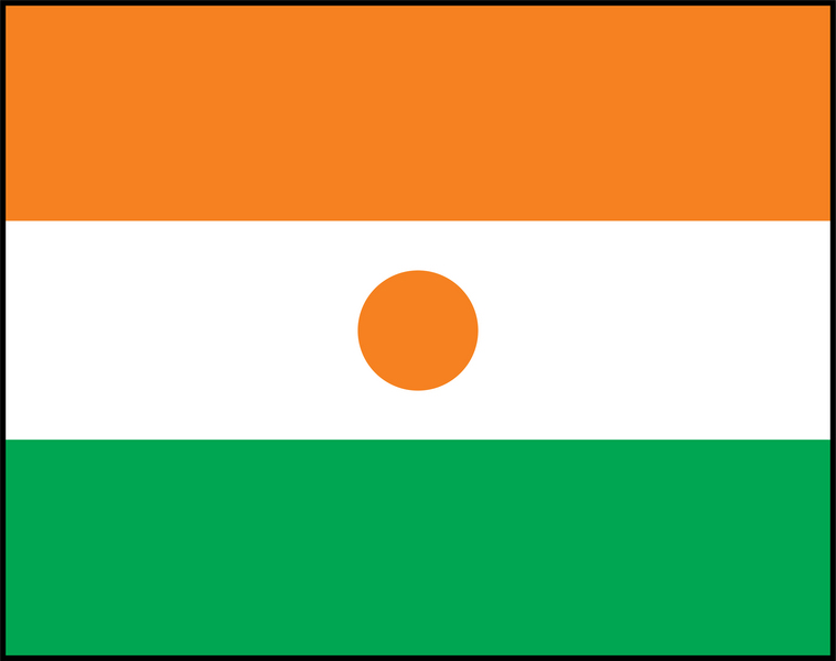
Niger is over 80 per cent desert, and its Tenere region holds one of the largest dinosaur graveyards ever found.
- CapitalNiameyOn the Niger River in the south-west
- PopulationAbout 26 millionThe fastest-growing population on Earth
- Area1,267,000 km2Over 80 per cent Sahara
- Birth rateThe highest in the worldAround 6.6 children per woman
Niger is a large landlocked country dominated by the Sahara. Over 80 per cent of it is desert, and almost the whole population lives in the southern strip along the Niger River and near the Nigerian border.
It has the highest birth rate in the world, with women having around 6.6 children on average, so around half the population is under 15. That creates enormous pressure on schools, food and water in one of the poorest countries anywhere.
National symbols
- National animal West African giraffe, the last wild herd in West Africa
- National colours Orange, white and green
- National anthem L'Honneur de la Patrie (Translation: The Honour of the Fatherland)
- National day Republic Day, 18 December
Map of Niger
Geography
Niger covers 1,267,000 km2 and borders Algeria, Libya, Chad, Nigeria, Benin, Burkina Faso and Mali. It is landlocked.
The Sahara covers the north, including the Tenere sand sea and the volcanic Air Mountains, which reach 2,022 m. The Niger River flows through the south-west corner, and the south-east reaches Lake Chad, which has shrunk dramatically since the 1960s.
Climate
Niger is one of the hottest countries in the world. The desert north is hyper-arid with almost no rain and summer temperatures above 45C.
The southern Sahel strip has a short rainy season from June to September, which is when nearly all farming happens. Droughts are frequent and severe, and desertification is pushing the usable land steadily southwards.
Culture
French is the official language, and Hausa, Zarma, Fulfulde and Tamasheq are widely spoken. The Tuareg of the north are famous for their indigo-dyed veils and camel caravans.
Around 99 per cent of Nigeriens are Muslim. The Cure Salee festival brings Tuareg and Wodaabe herders together at Ingall, where Wodaabe men perform the Gerewol, a courtship dance in elaborate face paint judged by the women.
Economy
Uranium is Niger's best-known export, mined in the north near Arlit, and the country is a significant world supplier.
Gold and oil are also produced. Most people are subsistence farmers and herders, and Niger consistently ranks near the bottom of the UN Human Development Index. Recurring drought and conflict make food security fragile.
The flag
Three horizontal bands of orange, white and green with an orange circle in the centre of the white band.
Orange stands for the Sahara Desert in the north, white for purity and the Niger River, and green for the fertile southern grasslands and for hope. The orange disc represents the sun and the sacrifices made by the people.