
Eritrea
Eritrea's capital, Asmara, is filled with 1930s modernist architecture and is a UNESCO World Heritage Site for it.
- CapitalAsmaraA UNESCO site for its modernist architecture
- PopulationAbout 3.7 millionOn the Red Sea coast
- Area117,600 km2Highlands and hot coastal desert
- Independence1993After a 30-year war with Ethiopia
Eritrea runs along the Red Sea coast in the Horn of Africa. A central highland plateau, where Asmara sits at around 2,325 m, drops away to hot desert lowlands on the coast and towards Sudan.
Eritrea fought a 30-year war of independence from Ethiopia, one of the longest in African history, finally becoming independent in 1993. That left Ethiopia landlocked.
National symbols
- National animal Camel, which appears on the coat of arms
- National colours Green, blue and red
- National anthem Ertra, Ertra, Ertra (Translation: Eritrea, Eritrea, Eritrea)
- National day Independence Day, 24 May
Map of Eritrea
Geography
Eritrea covers 117,600 km2 and borders Sudan, Ethiopia and Djibouti, with a long Red Sea coastline including the Dahlak Archipelago of over 200 islands.
A central highland ridge runs north to south, reaching Emba Soira at 3,018 m. West of it the land slopes to lowland plains, and east it drops sharply to a narrow, extremely hot coastal desert strip.
Climate
Climate depends almost entirely on altitude. The highlands around Asmara are temperate and pleasant all year, around 15C to 25C, with a rainy season from June to September.
The coastal lowlands are among the hottest places on the planet, regularly above 40C, with very little rain. The western lowlands are hot and semi-arid.
Culture
Eritrea has no single official language: Tigrinya, Arabic and English are all used in official contexts, and nine recognised ethnic groups speak their own languages.
The population is roughly split between Christianity, mostly Eritrean Orthodox, and Islam. Coffee ceremonies, injera flatbread and traditional white cotton clothing are shared with neighbouring Ethiopia after centuries of connection.
Economy
Mining is the main formal industry, especially gold, copper, zinc and potash. The Bisha mine has been the largest single project.
Most Eritreans farm or herd livestock. National service, which can extend for many years, and limited economic opportunity have driven large numbers of young Eritreans to leave the country.
The flag
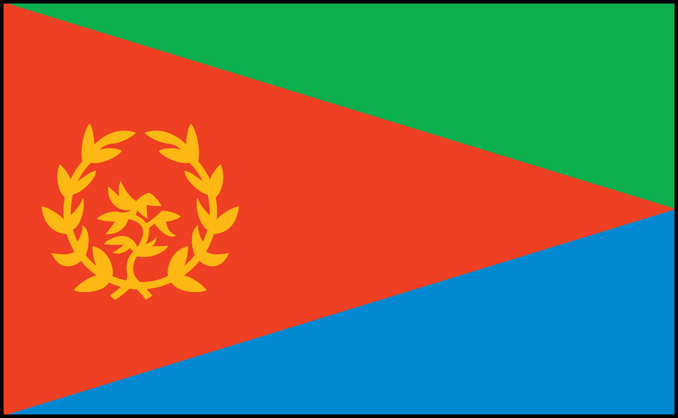
A red triangle based on the flagpole edge divides the flag into a green triangle above and a blue one below, with a gold olive wreath and branch inside the red.
Green stands for agriculture and the fertile highlands, blue for the Red Sea, and red for the blood shed in the long war of independence. The olive wreath was carried on the flag of the independence movement and stands for peace.