
Algeria
Algeria is the largest country in Africa, and around 80 per cent of it is the Sahara Desert.
- CapitalAlgiersOn the Mediterranean coast
- PopulationAbout 46 millionAlmost all in the northern strip
- Area2,381,741 km2The largest country in Africa
- SaharaAbout 80 per cent of the countryAlmost empty of people
Algeria became the largest country in Africa when Sudan split in two in 2011. Almost all of that area is Sahara, and nearly the whole population lives in a narrow fertile strip along the Mediterranean coast, backed by the Atlas Mountains.
Deep in the Sahara, the Tassili n'Ajjer plateau holds around 15,000 rock paintings and engravings up to 12,000 years old. They show giraffes, elephants, cattle and swimming figures, proof that the Sahara was once green grassland.
National symbols
- National animal Fennec fox
- National flower Iris
- National anthem Kassaman (Translation: We Pledge)
- National day Independence Day, 5 July
Map of Algeria
Geography
Algeria covers 2,381,741 km2 and borders Tunisia, Libya, Niger, Mali, Mauritania, Western Sahara and Morocco, with the Mediterranean Sea to the north.
The Tell Atlas runs along the coast and the Saharan Atlas further inland, with a high plateau between them. South of the mountains the Sahara stretches to the borders, rising to the volcanic Hoggar mountains where Mount Tahat reaches 2,908 m.
Climate
The northern coast has a Mediterranean climate with mild wet winters and hot dry summers, which is why the farmland and the cities are all there.
The Sahara is hyper-arid, with summer temperatures above 45C, almost no rainfall and enormous swings between day and night. Some Saharan areas can go several years without rain.
Famous landmarks
There are several famous landmarks, monuments and buildings in Algeria including the Casbah of Algiers, Al Qal’a of Beni, M’zab Valley, Notre Dame d’Africa, Makam Echahid (Monument des Martyrs), government offices and mosques.
Algeria has developed its tourist industry over the years and offers a selection of hotel accommodation, restaurants, bars and shops located mainly on the coastal regions in cities such as Algiers. Algeria boasts fabulous beaches and many famous landmarks and attractions for tourists to visit.
Algeria is famous for its stunning white buildings, mosques and architecture which can be observed at well known landmarks such as the Casbah of Algiers, Al Qal’a of Beni, M’zab Valley, Notre Dame d’Africa, and Makam Echahid (Monument des Martyrs). This North African country is also famous for its fantastic sand dunes which form part of the Sahara Desert region of Algeria. Some of the highest sand dunes in the world can be seen at the Grand Erg in the northeast of Algeria.
Culture
Arabic and Tamazight, the Amazigh or Berber language, are both official, and French is widely used. The Amazigh peoples are the Indigenous inhabitants of North Africa.
Almost all Algerians are Muslim. Rai music, which developed in Oran in the 1920s and became internationally popular in the 1980s, is Algeria's best-known musical export. Couscous, shared across the Maghreb, is on the UNESCO heritage list.
History
Evidence suggests that the history of ancient Algeria dates back 1.8 million years or more as the discovery of stone tools offer proof of early human existence. Later, the original people of North Africa (indigenous peoples) defended their land against various empires and invaders including the Phoenicians, Romans, Byzantines, Arabs, Turkish and French. The Arabic language was introduced to Algeria around 700-1000 AD, as was the religion of Islam too. The newly acquired language and religion brought significant changes to Algeria, defining its culture and identifying its people.
Algeria has been involved in numerous wars and conflicts throughout history, and has been under Spanish and French rule at various times. The French colonized Algeria and created the country’s modern day borders. Colonization of Algeria began in 1830.
A long and bloody war, known as the Algerian War of Independence, began on November 1, 1954 when a prominent attack was launched by a group opposing French rule known as the National Liberation Front. Another organization that strongly opposed French rule was the Algerian National Movement. The Algerian War of Independence, also known as the Algerian Revolution and Algerian Civil War, marked a significant turning point in history and resulted not only in independence for the country but sadly in the deaths of thousands of people also. Algeria gained complete independence in 1962 following the signing of a treaty on March 18, 1962 known as the Évian Accords. The Algerian War of Independence came to an end on November 19, 1962.
Economy
Oil and natural gas dominate, providing the large majority of export earnings. Algeria is a major gas supplier to Europe through pipelines under the Mediterranean.
Agriculture in the northern strip produces dates, citrus, olives and cereals. Algeria is one of the world's significant date producers, especially the deglet nour variety.
The flag
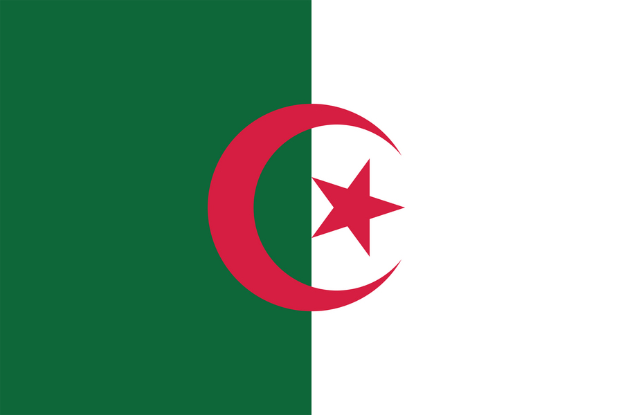
The flag is split vertically, green on the flagpole side and white on the other, with a red crescent and five-pointed star straddling the join.
Green stands for Islam and for hope, white for purity and peace, and the red crescent and star for Islam and for the blood shed in the war of independence against France, which lasted from 1954 to 1962. The crescent's horns are longer than on most flags, which Algerians consider a sign of good fortune.
